Innovative Approaches to Drone Image Management
for Structural Evaluations and Documentation
Who Needs to Document Structural Conditions and Why?
In view of the building collapse in Surfside, FL, and subsequent action by the State legislature (Florida Senate Bill 4D), many stakeholders, namely high-rise building owners, property management companies, building officials, engineers, and insurers, will need to document the existing conditions of structures.
Drones have already proved to be valuable in search and rescue operations, and after hurricanes, earthquakes, and similar natural disasters. They also play a major role in structural evaluation.
For consultants, drone surveys help in a detailed and thorough evaluation of structures. They aid in reducing report preparation time, categorizing the type of damage, determining the quantity and location of damage, providing evidence for expert witness testimonials, as well as optimizing project portfolio, marketing, and advertising. For property owners, they can be important in justifying maintenance and repair expenses and supporting insurance claims. Even contractors can benefit, from documenting pre-construction conditions and construction progress to providing as-built documentation (rebar, PT cables, utility piping layout in slab before concrete pour) and defending legal actions.
A drone survey of a typical building can generate over 100 GB (Gigabyte) of data including thousands of images and videos. Systematically viewing, sharing, and storing this data is a major challenge.
This paper will discuss the pros and cons of video versus high-definition still images, how to manage a vast amount of collected imagery, and how to view and share images on demand using different platforms (computers, tablets, or phones).
Video Vs. High-Resolution Still Images
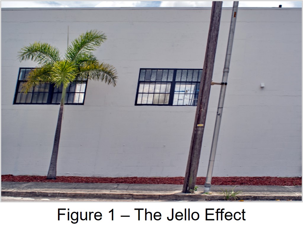
Capturing images using drones is an art! Besides flying skills and knowledge of drones, a drone operator should have good knowledge of photography and videography. The quality of video recording is subject to the type of camera shutter (electronic vs mechanical), frame rate, camera steadiness, and smoothness of panning. Video images tend to be of lower resolution than still images, and they have more compression noise. Also, electronic shutters often produce distortion called rolling shutter. This is also known as “The Jello Effect” (Figure 1).
Therefore, video recording may be convenient but not very practical for capturing details. During video recording, the drone is moving continuously. In any given video, one must watch the entire footage to pinpoint a location of interest; and there are often several videos of each structure to watch. This requires tedious time-tagging by someone who is both familiar with the structure and good at problem identification. In reality, videos are best suited for real estate professionals to highlight structures in relation to their surroundings for prospective buyers.
It is important to stress that the flight time of all drones is limited by battery life. Thus, it is critical that each flight is well planned and executed to acquire the maximum information possible.
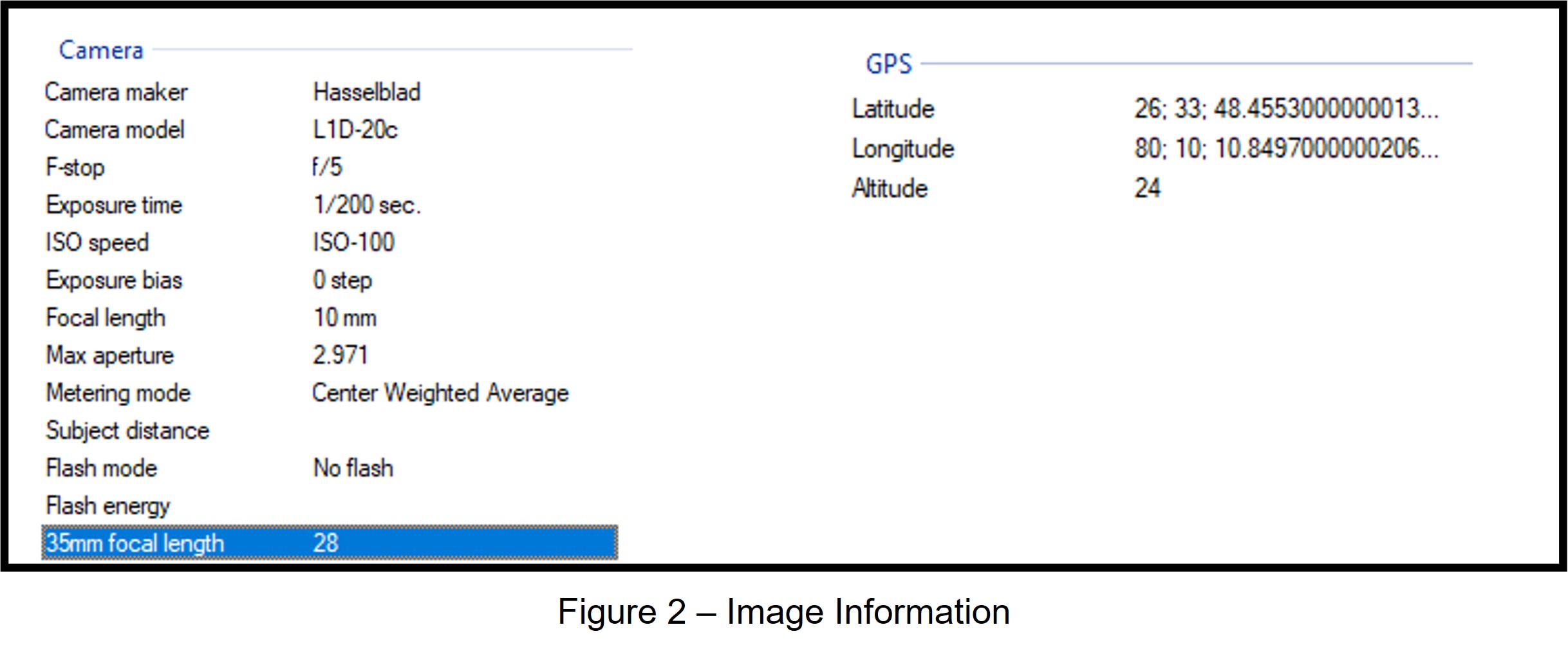
Many drones today have the built-in capability of producing panoramas from a collection of high-resolution still images, captured while rotating a drone 360 degrees. Each image also contains data such as ISO, exposure, GPS coordinates, and altitude as seen in Figure 2.
This information is useful in building a database with powerful indexing functions that link to a visual map and allow users to access any image quickly. Also, still images tend to be of much higher resolution (most drones allow the storing of raw images which are typically 2-3 times larger in file size compared to typical JPEG format). Most importantly, images can be stored on the cloud and accessed via a simple interface.
Regardless of who needs information and for what purpose, information is only good if it is made available when needed. That said, not all consultants conducting structural evaluations need to be certified drone operators. A qualified drone operator can perform a survey with detailed instructions from an engineer, saving time and expense.
Innovative Image Management System
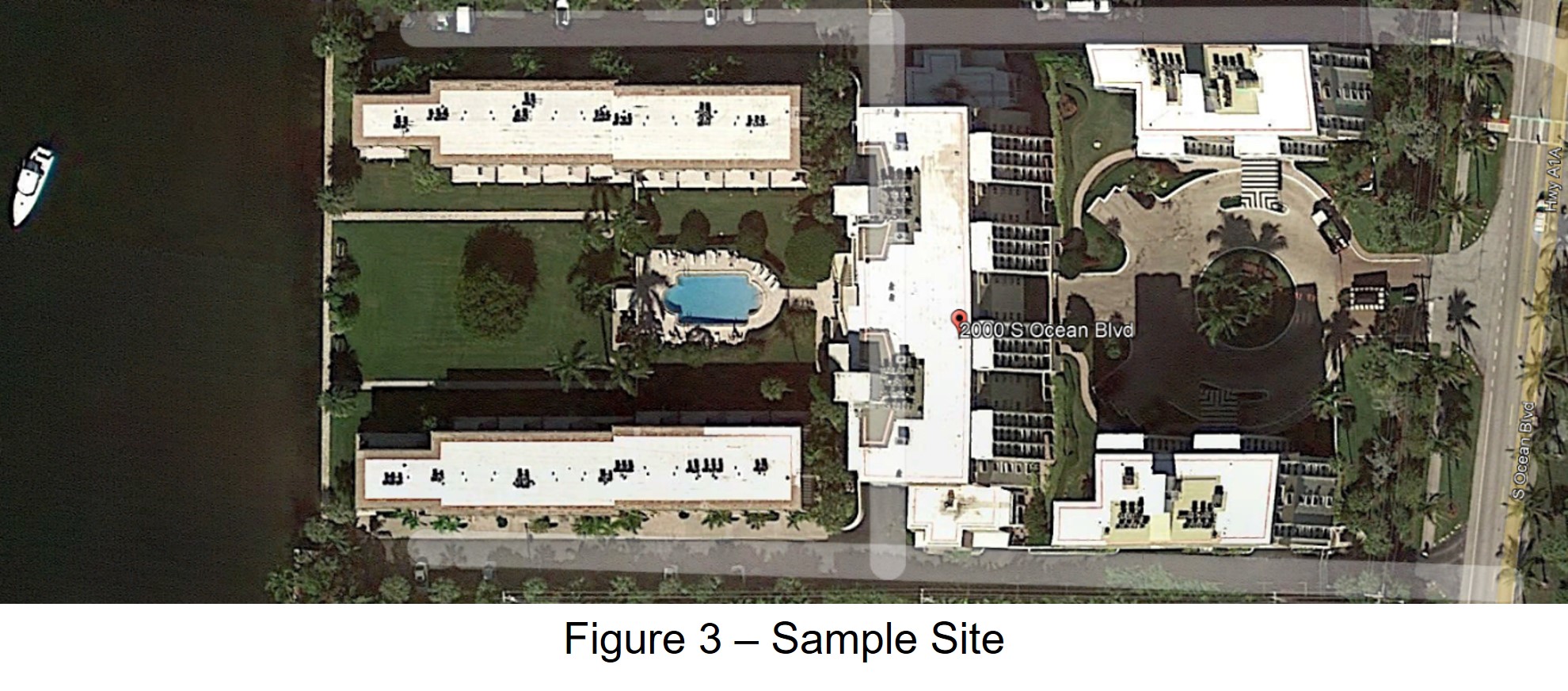
As explained before, still images have the unique advantage of being easy to index. Innovative image management systems automatically catalog drone data as illustrated in the example below. Figure 3 shows a sample site located on the intercoastal waters in South Florida.
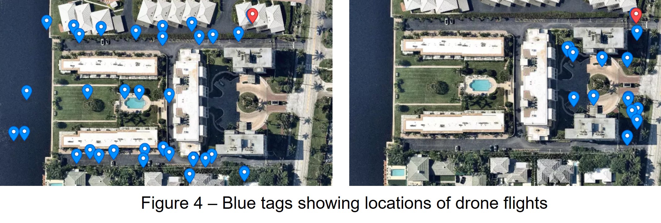
The site was imaged with a drone on two consecutive days. Figures 4 and 5 show the locations of the drone flights.
At each of the locations, a drone was flown to various heights, and at each height, a panorama was captured. A drone is always oriented towards the structure to lock in the exposure of the camera. This avoids wash-out or darkening of the subject. To access a panorama at a specific height, one clicks on any blue tag and selects the height from the pop-up table (Figure 5a).
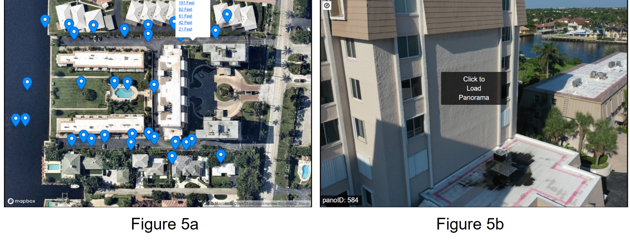
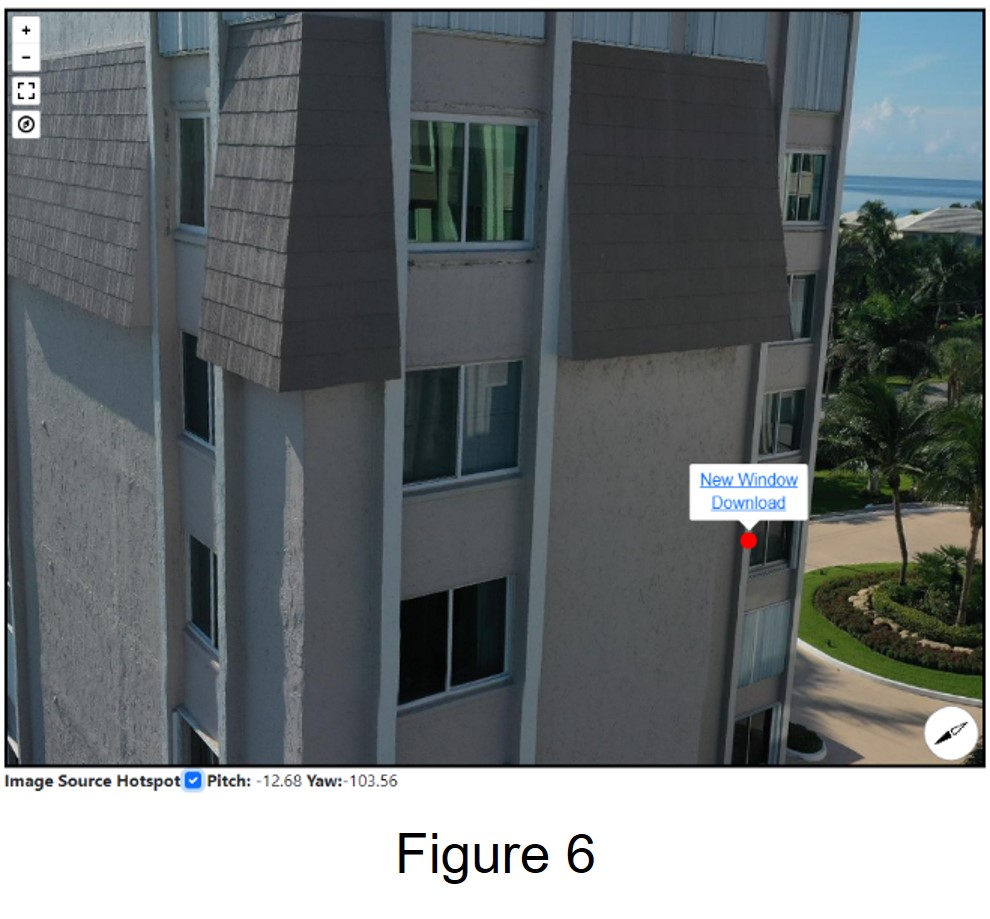
This opens a panorama at the chosen height in an adjacent window (Figure 5 b). After clicking to load the panorama, the user is free to move around, 360 degrees. This allows the user to examine a point of interest in the structure or in the surrounding area. A user can also zoom in or view the structure in full screen. At this point, the user has the choice of capturing the screen or checking the hot spot checkbox at the bottom of the window, which displays hot spots as red circles. These red circles are pointers to the actual drone images stored in the cloud.
Clicking on any of the hot spots activates a pop-up window asking the user to either view the actual image in a new window or download a high-resolution image to their device (Figure 6).
Another Application for Image Management Systems
As seen above, the image management system makes use of panoramas, allowing users to navigate through the image database and access only images of interest. Any other imaging source capable of producing 360-degree panoramas can also benefit from this system.
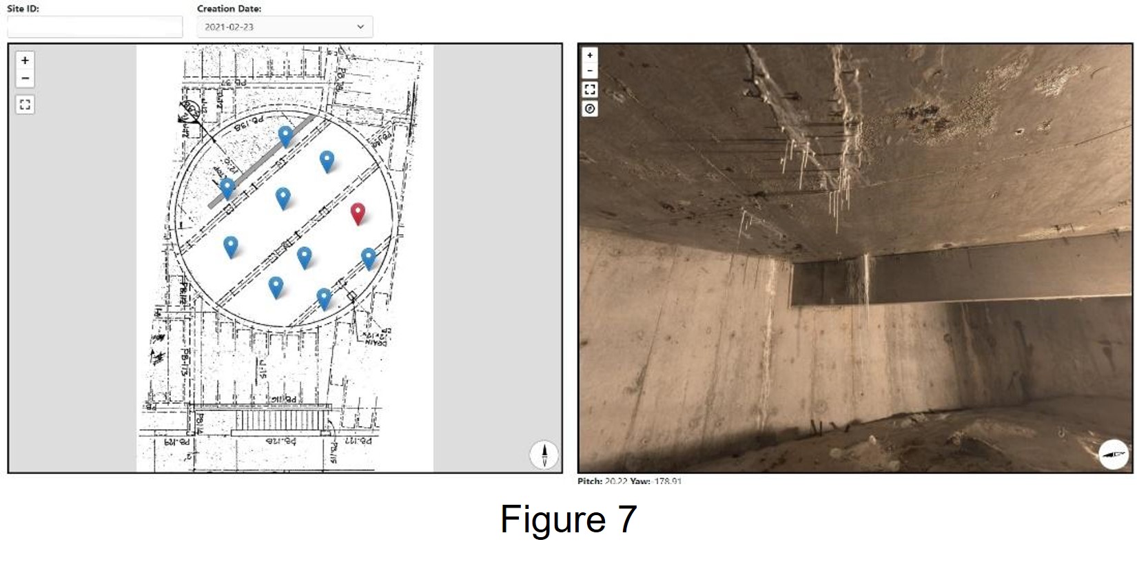
For example, there are instances where a drone cannot be used. Confined spaces such as attics, parking garages, and crawl spaces can be inspected using a 360-degree camera. The following example utilizes a device with 25 built-in cameras capable of instantaneously generating extremely high-resolution panoramas. Although this device can capture GPS data, GPS information in confined spaces is not always available. In such cases, an image of an existing plan of the area is sufficient to visually display image management system data points and the panoramas themselves. And since the panoramas are high resolution, any view of a panorama can be saved as a high-resolution screen capture.
Figure 7 shows the underside of an elevated swimming pool slab which was accessible only through a small opening in the surrounding walls. The imaging device was mounted on a tripod and the entire underside of the slab was mapped in only 11 panoramas in 30 minutes!
Major Benefits of an Image Management System
- Ease of use: Simple, intuitive interface
- Password protected
- Data stored in the cloud frees valuable hard disk space
- Data viewed on multiple devices (computers, tablets, and phones)
- Ease of collaboration: Visual emphasizing tool, discuss problems and solutions, file sharing
- Surveys repeated at approximately the same locations to show time history, progress of work, progression of damage, event-driven damage for insurance claims
- Subscription-based data storage and retrieval plans ensure the long-term availability of image database
Future Implications
- Drone technology is improving and expanding rapidly. As battery life, and hence flight time, improves, structural evaluation of complex structures with drones will be even more economical.
- Improved cameras produce much higher-resolution images.
- Need for more trained, certified drone operators
- Increase subscription-based cloud storage options at a lower cost
- Possibility of incorporating photogrammetry in the image management system
- Since April 2021, FAA regulations have addressed limited night-time drone flights. This could open up the possibility of performing thermal imaging at night.
- Infrared inspections of roofs
Copyright 2024 SRI Consultants, Inc.
All rights reserved.
